Infrastructure in the Era of Westward Expansion
Lesson Components
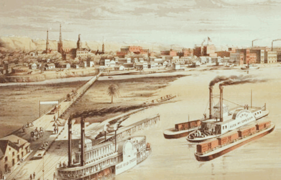
Western Expansion Middle School Interactive Timeline NotesGuiding Questions
How did economic factors drive westward expansion and create new opportunities and challenges?
Objectives
- Students will…
- Analyze how infrastructure projects supported economic expansion in the Early Republic.
- Identify key political and technological developments that shaped westward growth.
- Make connections between transportation innovations and patterns of trade and settlement.
- Demonstrate understanding through a 3D model that visually represents historical ideas.
Student Resources:
Teacher Resources:
- 3×5 index cards for speeches
- Legos, play-doh, paper, recyclables, cardboard, clay or other available resources for modeling
Facilitation Notes
- This lesson includes a 3D modeling assessment. Students will need time, space, and permission to get a little messy. If this type of hands-on activity is unusual at your school, consider giving advance notice to families and administrators.
- This lesson pairs nicely before or after the Geography and History: A Map-Based Inquiry Lesson
Anticipate (Optional)
- Glossary term:
- Infrastructure
- Introduce the term by saying:
“A key word for today is infrastructure. The prefix infra- means ‘within’ or ‘inside,’ and structure means ‘a built system or foundation.’ So, infrastructure refers to the physical systems that support a country’s economy and society – things like roads, canals, and bridges.” - Project a Frayer Model onto the board. Assign student groups different sections of the model: Definition, Characteristics, Examples, and Non-Examples.
- Students can plan in their groups and then take turns coming to the board to add their information.
Engage
Interactive Timeline Guided Notes
- Transition: Prepare students for independent work and ensure students have digital access to the America in Transition Interactive Timeline.
- Students will use the timeline to complete their own copy of the Interactive Timeline Notes.
- Students will focus on the following timeline events:
- Henry Clay’s American System
- Erie Canal Completed
- National Road Completed
- Andrew Jackson Vetos the National Bank
- Asa Whitney Proposes Transcontinental Railroad
- Teacher Note: The Interactive Timeline Notes handout is purposely left blank in order to be used with other timelines, if desired. There is an Interactive Timeline for every unit of the curriculum.
Explore
Connecting Innovations to Impact
- Create a cause-and-effect chart on the classroom board or digitally. Use one column for innovations (e.g., canals, railroads), one for economic outcomes (e.g., cheaper goods, faster travel), and one for societal changes (e.g., westward migration, regional trade links).
- Assign each student or pair one key innovation or infrastructure project from the timeline. Ask them to trace how it impacted:
- Economic growth
- Travel and trade
- Political decisions or conflicts
- Prompt discussion with questions like:
- Who benefited most from this innovation?
- What new opportunities did it create?
- Were there any unintended challenges or consequences?
Assess & Reflect
3D Model Creation
- Prompt:
Using your notes, build a 3D model that shows how economic ideas and infrastructure developments connected the Early Republic. Your model should represent:- Economic plans (ex: Clay’s American System)
- Key transportation projects (ex: Erie Canal, National Road, early railroads)
- Political decisions (ex: Jackson’s veto of the Bank, Congressional railroad surveys)
- Challenges/opportunities created by expansion
- Guidelines:
- Each major concept must have a clear physical representation (ex: a bridge, a station, a toll booth).
- Connections between ideas must be shown – like roads between settlements, canals linking regions, or barriers representing challenges.
- Include labels or a key to explain what parts of your model represent.
- Your model can be built from paper, cardboard, clay, Legos, recyclables, or digital tools (like Minecraft or Tinkercad).
- Ideas for specific representations:
| Concept | 3D Representation Idea |
| Clay’s American System | Central “hub” (like a city plaza) where tariffs, banks, and roads branch out |
| Erie Canal | A blue river cutting across a “landscape” with “ports” (mini docks) |
| Railroads | Strips of black paper or tracks connecting regions |
| National Bank | A “bank building” in the center that students can show being “cut off” to represent the veto |
| Westward Expansion | Wagons, trails, new “settlements” |
A simple 3D rubric you could use:
- 4 points: Clearly represents at least 4 key concepts.
- 4 points: Shows connections between economic, political, and geographic ideas.
- 4 points: Includes labels or key explaining the model.
- 4 points: Model shows creative thinking and historical accuracy.
AND/OR
3D Model Museum
- Students act as living exhibits in a “wax museum” format. Each student creates a small button and a short script on a notecard explaining how their model shows cause and effect in infrastructure and expansion. When classmates “press” the button, the student delivers their explanation aloud.
Extend (Optional)
- Ask students how our infrastructure today compares to the infrastructure of the nineteenth century. For example, electrical power, internet, and self-driving car technologies.